You are in:
- Start
- Interviews
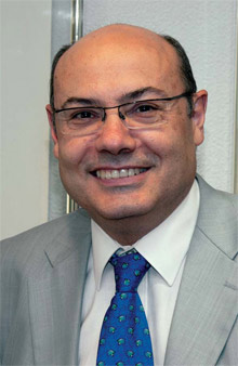
- Ricardo García Herrera. President of the Spanish State Meteorological Agency, AEMET. Madrid - Spain
Ricardo García Herrera. President of the Spanish State Meteorological Agency, AEMET. Madrid - SpainNATURAL PERILS
Ricardo García Herrera was born in Valladolid in 1958 and holds a Doctorate in Physics from the Complutense University of Madrid, where he is also a Professor. He is a graduate of the IESE Management Programme as well. He considers himself to be a climatologist –an expert on climate– with extensive experience in the analysis of climatic variability and its impact on public health. His career has been a mixture of university life and the field of management and public institutions. He started working at the age of 22 as an assistant at the Complutense University and took advantage of those early years to write his doctoral thesis on air pollution models. In addition, he also specialised in the environment and public health, which led him to leave his work mark on various bodies in the Autonomous Regions of Castile and Leon, Navarre, the Basque Country and Madrid. He went on to become the Director of Public Health for the Basque Government and Director-General for Prevention and Health Promotion of the Regional Government of Madrid.
Ricardo García Herrera is the author of more than 80 scientific and research articles published in international journals and he has also written various books. He has coordinated numerous national and international research projects and also the Master’s Degree course in Geophysics and Meteorology at the Complutense University. He has been a contributing author to the IPCC’s Fourth Report and represents Spain on different international programmes. He was appointed President of the Spanish State Meteorological Agency, AEMET, at the suggestion of the Ministry for the Environment and Rural and Marine Affairs on 12 February 2010.
“The future depends on improving weather forecasting and offering more climate information”Concerns about weather and climate have become two constants in our lives, supported by ever more precise and accurate forecasting models. Learning first hand about the objectives and daily work of Spain’s State Meteorological Agency, as well as its most pressing challenges, from the words of its President is a real treat on account of both the information provided and the simplicity with which its development over 125 years is explained.
Broadly speaking, how was the historical
development of meteorological services in
Spain up to the establishment of the State
Meteorological Agency?
AEMET is the continuation of an organisation
which in 2012 will formally be 125 years old,
although its origin is even older. It became
a State Agency at the beginning of 2008, and
so we are a bit like a Directorate-General,
but with more competence; for example, we
have some degree of freedom as regards the
management of resources, be they budgets
or personnel.
In Spain, meteorology arose from astronomers
who, depending on weather events,
like the presence or lack of clouds, could
observe the sky. The beginnings were in some facilities at El Retiro Park in Madrid,
and for a long time a strong statistical approach
involving tables of meteorological
data prevailed, but this offered little forecasting
capability. This led to a delay of
about 40 years in the creation of Spain’s
Meteorological Service compared with
those set up in the UK, Germany or France,
a lag further aggravated by problems relating
to the competencies and capacities
of local bodies and bureaucracies. Finally,
the Central Meteorological Institute
was merged with the Retiro Observatory.
These facilities still exist and now belong
to AEMET. Until 1976, the organisation was
called the National Meteorological Service
and was dependent on the Air Ministry. It
was then run by the Transport Ministry and
was called the National Meteorological Institute.
Finally, it depended on the Ministry
for the Environment and Rural and Marine
Affairs and, through the Secretary of State
for Climate Change, became the State Meteorological
Agency (AEMET) and assumed
all the competencies of the former National
Institute of Meteorology (INM).
Our functions are to protect people and property by forecasting the weather and supporting environmental and climate change policies
What are AEMET’s mission and roles?
We are an atypical agency because although
the main mission of meteorological agencies
and services is to help protect people
and property by forecasting the weather,
we combine other functions, like supporting
environmental and climate change
policies. This means that, besides making
short- and medium-term forecasts, we
produce climate scenarios which can be
accessed on our website. We support environmental
quality policies by, for example,
designing air-quality forecasting models.
We also manage the Spanish background
pollution monitoring network. This means
that we have about twelve sensors installed
outside cities which are not disturbed by the
emissions from any big city and help us to
measure the background pollution and also
the transboundary transport of air pollutants.
AEMET is not an organisation dedicated
to R&D –research and development–
but it needs to be up to date, as we use very
advanced technologies such as space- and
ground-based remote sensing.
We are also the government body for matters of international cooperation on the
subject of meteorology and climate. We
maintain two very active programmes, one
in Latin America and the other in Western
Africa.
What resources do you have?
We have about ninety workplaces and a staff
of 1,300 highly-skilled people who fit three
types of profiles: meteorologists, who carry
out development and management tasks;
graduates, most of whom are in charge of
weather forecasts; and then observers, who
take care of operating and maintaining the
observation network. A third of the staff are
located at our headquarters in Madrid. The
rest are integrated into seventeen territorial
delegations, one for each Autonomous Region,
and we also have eleven forecasting and
monitoring groups. These groups manage
warnings and forecasts from the regional
point of view. There are also personnel in all
observatories, air bases and airports.
What weather hazards can threaten a territory
like Spain?
Given our characteristics, what worries us
now is a phenomenon which is very difficult
to predict: storms and what is commonly
known as “gota fría” (literally: “cold drop”),
which is actually an atmospheric structure
in which cloud systems that are small in
size and short-lived develop but cause very
intense precipitation. With these characteristics,
it is very difficult for a forecasting
model to give a sufficiently accurate warning.
We are making efforts to downscale our
predictions.
AEMET is not an organisation dedicated to R&D –Research and Development– but it needs to be up to date, as we use very advanced technologies such as space- and ground-based remote sensing
How is your forecasting system organised?
Thirty-five years ago, various European
meteorological services decided to combine
forces and create a centre of excellence for
making very good medium- and long-term
forecasts: the European Centre for Medium-
Range Weather Forecasts (ECMWF) in
Reading in the United Kingdom, which
is rated the best in the world. The
ECMWF provides two daily forecasts on a
hemispheric scale, at midnight and midday,
with a resolution of about 15 kilometres. We
then use this information to run our own
high-resolution model for two areas – one
centred on the Iberian Peninsula and the
other on the Canary Islands – to release four
daily forecasts. All AEMET products such as
warnings and different types of forecasts
are produced from these models. What we
are now working on is to increase the ten- or
fifteen-kilometre resolution of the current
models to a one-kilometre resolution, which
will be available in 2013 or 2014.
Does a weather forecast accurate to a kilometre
not seem very ambitious?
Yes, it does. The strategic plan approved
last June for the ECMWF includes the aim of
getting down to the one-kilometre scale, but whereas the Centre proposes achieving this
by 2020, we want to get ahead of that date
with our model at the Agency. To do this, we
are going to get a new supercomputer which
is going to entail considerable expenditure
but will allow us to optimise the complexity
of the calculations that need to be made.
One of the specific features of meteorology
is that it presents situations which are very
difficult to predict, such as storms and fogs,
which have a very local effect and greatly
affect aviation. The movements of fronts,
however, are much more predictable.
What work are you developing in relation to
climate change?
We are concerned with how the climate is
evolving. As part of a programme coordinated
by the World Meteorological Organization
(WMO), normal climatic conditions (see pp.
34) have been being measured since about
1970. For this, climate periods of 30 years
are used and we see how all the variables
develop, but especially temperature and
precipitation. We have twenty-seven topquality
meteorological stations devoted
to this, and these will support climate
change data in the medium and long
term. Precipitation patterns have not
changed since 1970, but temperature has.
Whereas between the periods 1961-1990
and 1971-2000 the average temperature in
Spain increased by 0.22ºC, it increased by
0.46ºC between 1971-2000 and 1981-2010,
doubling the observed variation between
the previous two reference periods.
Serious attention needs to be paid to this
question. It is not a prediction but a fact.
This will certainly trigger changes to the
water cycle. When it rains, the rainfall will
be very intense, and then there will be long
periods of drought.
The ‘gota fría’ is an atmospheric structure in which cloud systems develop which are small in size and short-lived but cause very intense precipitation. With these characteristics, it is very difficult for a forecasting model to give a sufficiently accurate warning
Do all meteorologists use your services? Is
it a driver for your marketing?
Some meteorologists use our services,
others don’t. AEMET’s priority is to be an
efficient public service. For example, we
have a new data policy. Until a year ago,
you had to pay to get the data. Now we have
decided that it is better for them to be freely
available on our website, where there is a
lot of information which is not shown only
in the form of graphs but also by means of
data files that can be used by professionals.
When you consider that citizens pay for the
content produced by AEMET through their
taxes, it is logical for that information to
go back to them. Secondly, we have learnt
that, by making it freely available, we are
helping the meteorological industry, which
is immersed in a process of improvement.
In the 1960s, forecasting was an art that
depended on the way the meteorologist on
duty had been trained. Currently, meteorology
basically depends on the interpretation
of models, making it much more systematic
and scientific. As there are many small users
with specific requirements, our role focuses
on the one hand on laying the foundations
so that anyone can obtain this information
and, on the other, on taking care of large
institutional users: civil defence, aviation and
the armed forces, for example. In the months
that this policy of transparency has been in
operation, users have downloaded around a
hundred thousand files per day from us. We
are the most-visited Spanish institutional
website, with around 3.5 million visits each
day, and the usage profile is growing. This is
the best quality control we can have.
Whereas between the periods 1961-1990 and 1971-2000 the average temperature in Spain increased by 0.22º C, it increased by 0.46º C between 1971-2000 and 1981-2010
In what way are you collaborating in the programmes
in West Africa and Latin America?
We are the World Meteorological
Organization’s foremost contributor for the
areas of cooperation, our contribution being
channelled through conferences in which the
directors of hydrometeorological services
take part. We are very keen in knowing their
needs and try to meet them. On this basis, a plan of action is set in motion using the
resources available to us at any time. We offer
training and exchange programmes and
courses, as well as access to some technologies,
like handling the output from the
ECMWF’s models; we also make Meteosat
images available. In the area of Africa
extending from Mauritania to Guinea, we
are carrying out three programmes: a
meteorological one to support fishermen;
another one dealing with meteorology and
health; and another focused on agriculture.
Four hundred metereological stations have
been set up, spread across various zones, in
order to help them take decisions on sowing
or watering. In addition, and more generally,
they are given forecasts for sand and dust
storms, which is something truly novel and
useful for this entire region.
What is your most immediate challenge?
Our main challenge is to get the new Climate
Services Site up and running as part of the
Agency’s new data policy. It is possible to give a lot of very useful climate information not
only through lists of data but also through
threshold values, projections, forecasts
or normal values, amongst other things,
so that each user can use the information
as required. This is so important that at
the WMO’s last congress in June, it was
suggested that an extraordinary congress
be held. Generally speaking, the European
meteorological services are going to
continue improving smaller-scale weather
forecasts and are going to provide more
climate information. This is an important
development for the whole world and we
are very well positioned for offering these
services.
How do you interrelate with insurance?
Our experience is basically linked to the
Consorcio de Compensación de Seguros
(Insurance Compensation Pool), to which
we supply the data they request on certain
climatic events that have a major claims
impact, such as windstorms or tempests.
| Reference period | Annual average temperature in Spain | Difference between two consecutive periods |
|---|---|---|
| 1961-1990 | 14,43 ºC | |
| 1971-2000 | 14,63 ºC | + 0,20 ºC |
| 1981-2010 | 15,09 ºC | + 0,46 ºC |

Variation in average temperature in Spain between the 1971-2000 and 1981-2010 reference periods [Source: AEMET “Note on the average variation in temperature and precipitation in Spain between the 1971-2000 and 1981-2010 reference periods”]
Our main task is to take note of what is happening with regard to climate change and to communicate it.
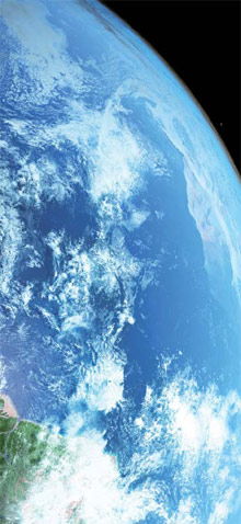
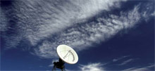
The use of satellites
Do you have your own satellites?
No country in Europe owns satellites. In
1986 the European countries decided to
create a consortium known as EUMETSAT,
with its headquarters in Germany, to operate
weather satellites at European level. It
combines various types of programmes:
the Meteosat programme, a set of geostationary
satellites which capture images of
Europe every 15 minutes; the polar satellite
programme, offering images of different
strips of the Earth on each pass; and then
there are others, like the Jason programme,
dedicated to monitoring ocean variations.
The satellites are launched from French
Guyana. Our participation is the fifth largest
in this consortium through Spain’s financial
contribution of eight per cent. This contribution
is made on the basis of gross domestic
product.
What has the use of satellites meant for
weather forecasting, and how long have
they been used?
The satellite images that we see on television
each day are the input data for obtaining
the weather diagnosis and forecast. In
fact, we could not make the planned jump
to a kilometre-scale forecast without the
help of satellites. Last year at EUMETSAT
they approved the construction of the thirdgeneration
Meteosat, which will probably
be operational in 2017. This will allow a
higher resolution and offer more variables,
thereby improving the forecasting quality.
Comparable services
Is Spain an advanced country when it comes to weather services?
I would support that. The quality of our forecasts is essentially
the same as in the rest of the advanced countries of Europe.
And from the point of view of your available resources?
We have what is necessary to become members of various
European consortia. Meteorology has been a global science
since the invention of the telegraph and the first weather
maps were produced from the meteorological data that
were transmitted, with observations being transferred
in this way to forecasting maps. At AEMET we also have
antennas to receive images and data from the US satellites
operated by the National Oceanic and Atmospheric
Administration (NOAA), which means that we do not have any
problems in terms of lack of technical equipment.
It is said that in 2012 there will be problems with solar winds
that will impact on communications. Will they be affected?
There are certain concerns. At the last meeting of the
American Meteorological Association, NOAA put forward a
proposal on the need to do more in-depth work on this. The
subject is not exactly meteorological but about the impact on
satellites and communications.
Worrying for the climate
What is being observed on climate
change?
There are two aspects concerning
climate-change support policies. One
is monitoring, which is not only for
forecasting but is also used for climatology
and for observing changing trends.
Our main task is to take note of what
is happening and to communicate it.
Our other role is related to scenario
modelling. Climate scenarios up to
the year 2100 can be downloaded from
AEMET’s website for each Autonomous
Region, something that has been done
at the request of the sectors involved.
The public feel that climate activity
may have some impact on their lives
and their activities. These models
and the agreed scientific evidence
say that by the end of this century, we
will suffer temperature increases of
between 3 and 5 degrees. Right now, there is no scientific tool better than
climate models. They conclude what
would happen if the rate of emission
of greenhouse gases does not change,
and this is not a prediction but a
projection.
According to environmentalists, if we
do not reduce greenhouse emissions,
climate change may become irreversible.
Once greenhouse gases are released
into the atmosphere, they remain there
for hundreds of years. Some of them
remain for a longer time whereas
others stay for less. Any solutions
adopted now will be felt within 30 or
40 years. We do not have scientific
evidence that might lead us to think
that this is not being caused by human
action; in fact, if we try to explain how
the climate has developed in recent
decades with our best models, the change is not adequately reflected,
and we only succeed if we simulate the
effect of greenhouse gases increase.
It is therefore irresponsible to ignore
this, which means that we must try
to reduce emissions. But the problem
is quite complex. It requires political
decisions affecting development and
life quality, which must be adopted
by all countries, and, as we all know,
there are some countries that are not
willing to do this for the time being.
What is the value of climate forecasting?
Climate projections, and particularly
those of a regional scale, constitute
one of the essential starting points for
assessing impact, vulnerability and
future needs to adapt to climate change.
For AEMET, this is therefore a key priority
in its objective of providing the most
effective weather and climate information
for citizens. The first regionalised
projections of climate change were
presented by the Agency in 2007 and the
information generated was immediately
uploaded on to the Website and made
available to users. In July 2010 the
second phase of updating these regionalised
scenarios was carried out
using new data from the global models.
It resulted in the basis of the Fourth
Assessment Report of the Intergovernmental
Panel on Climate Change
(IPCC), approved in Valencia in 2007.
And when this interview is published,
the Agency will already have more
detailed results from various statistical
dynamic models available and freely
accessible on its website. All this
demonstrates the Agency’s desire
to always offer the best available
information on the probable development
of the climate in Spain.
Normal values
In climatology, the normal value of a climatic factor is the average value over a period of time that is long enough to allow short-term fluctuations, i.e. such as interannual variation. In order for climate data to be compatible and comparable in the various regions of the planet, the World Meteorological Organization (WMO) has defined a time interval of 30 consecutive years to calculate these normal climatological values, this period being known as the “reference period”.
Source: AEMET “Note on the average variation in temperature and precipitation in Spain between the 1971-2000 and 1981- 2010 reference periods”.
For more information, please look up:
- AEMET
www.aemet.es - ECMWF: European Centre for Medium-Range
Weather Forecasts
www.ecmwf.int - WMO: World Meteorological Organization
www.wmo.int - EUMETSAT
www.eumetsat.int - NOAA
www.noaa.gov - IPCC Intergovernmental Panel on Climate Change
www.ipcc.ch
 © AEMET
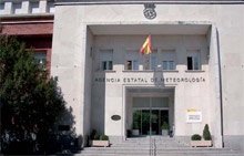 AEMET Headquarters
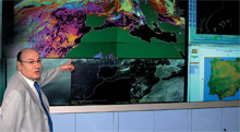 Ricardo García at the AEMET forecasting room
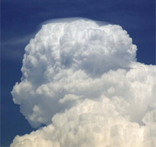
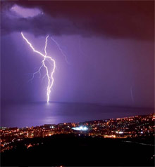 Electric storm at Barcelona. Spain
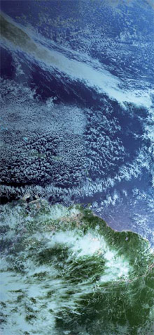
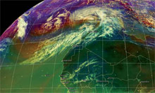 Cynthia storm image captured by Meteosat-9 (27th February 2010)
© 2010 EUMETSAT
Cynthia storm image captured by Meteosat-9 (27th February 2010)
© 2010 EUMETSAT
 © AEMET